Grodowa góra
Ort
Choćebuz
Ort
Choćebuz
Category
Bodendenkmale
Category
Bodendenkmale
Kurzbeschreibung
The area known today as the “city crown” was developed in several construction phases, beginning in the 9th century with a Slavic rampart built of wood and earth. Together with neighbouring slavic settlements it formed the easternmost fortification complex of the West Slavic tribe of the Lusici/Lausitzers.
Extended description
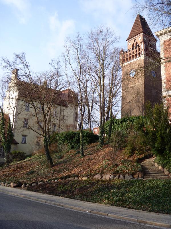
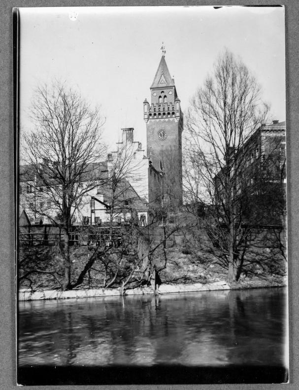
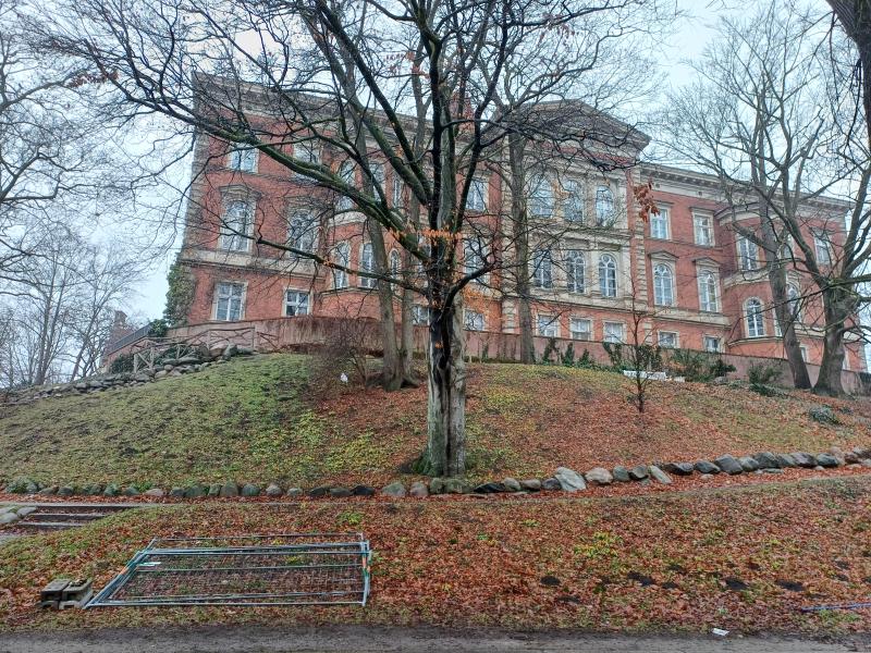
The fortress protected the nearby crossing of the river Spree and later remained important as a market, trade and administrative centre, similar to Bautzen. From 1156 it had the status of a burgrave's seat (castellan). The name 'Schlossberg' (castle hill) became increasingly common with the lordly family 'von Cottbus', which had been resident here since 1199, and their buildings. With the Peace of Guben of 1462 at the latest, the rule over Cottbus fell to the Elector of Brandenburg. Subsequently, the buildings on the Schlossberg were used as the administrative centre of the sovereign, later as the residence of the governor and also as the seat of the provincial governor's office.
From the 18th century onwards, the Cottbus castle complex served as a prison, army magazine and salt depot until it was assigned to a woollen yarn spinning mill from 1816. In 1870, the judicial administration acquired the castle grounds, which had been ruined by fire, and had the district court built in 1874-78 and the local court in 1905.
Extended description
The fortress protected the nearby crossing of the river Spree and later remained important as a market, trade and administrative centre, similar to Bautzen. From 1156 it had the status of a burgrave's seat (castellan). The name 'Schlossberg' (castle hill) became increasingly common with the lordly family 'von Cottbus', which had been resident here since 1199, and their buildings. With the Peace of Guben of 1462 at the latest, the rule over Cottbus fell to the Elector of Brandenburg. Subsequently, the buildings on the Schlossberg were used as the administrative centre of the sovereign, later as the residence of the governor and also as the seat of the provincial governor's office.
From the 18th century onwards, the Cottbus castle complex served as a prison, army magazine and salt depot until it was assigned to a woollen yarn spinning mill from 1816. In 1870, the judicial administration acquired the castle grounds, which had been ruined by fire, and had the district court built in 1874-78 and the local court in 1905.
Koordinaten
51.76168
14.33954
14.33954
Koordinaten
51.76168
14.33954
Literaturreferenzen
Ackermann, Irmgard/Cante, Marcus/Mues, Antje 2001: Denkmaltopographie Bundesrepublik Deutschland. Denkmale in Brandenburg, Stadt Cottbus, Bd. 2.1, Worms, S. 169–170.
Wetzel, Günter: Der Schloßberg in Cottbus. In: Veröffentlichungen des Museums für Ur- und Frühgeschichte 23 (1989), S. 181–207, insbesondere die Tafeln 36-43.
Wetzel, Günter: Untersuchungen am Schloßberg von Cottbus. In: Ausgrabungen und Funde 17 (1972) 3, S. 151–157.
Photos